Thailand's Mekong border road runs for the better part of 700km, from Chiang Khan in Loei province round the top of Isaan to Nong Khai, then east and south through Bueng Kan and Nakhon Phanom to Mukdahan. Two road numbers do most of the work: Route 211 on the western section and Highway 212 on the eastern one.
The honest headline first. This is sold as a road that follows the Mekong, and for long stretches it does not. Route 211 between Sangkhom and Chiang Khan is genuinely riverside driving, with the water and the Lao mountains beside you for kilometre after kilometre. Highway 212 north-east of Nong Khai spends much of its length a few kilometres inland behind rubber and rice, giving you glimpses rather than views. Knowing which is which is the difference between a great trip and a mildly disappointing one.
- Full runAbout 700km, Chiang Khan to Mukdahan
- Best sectionRoute 211: Nong Khai to Chiang Khan, about 200km
- Time4-7 days
- Best seasonNovember to February
- VehicleCar, or any bike over 150cc
The western section: Route 211
Route 211 links Nong Khai to Chiang Khan along about 200km of river bank, and it is the best drive in northeastern Thailand. The road is well sealed, two lanes, lightly trafficked, and for long sections it runs directly along the top of the bank with the Mekong on one side and villages on the other.
| Leg | Roughly | River in sight? |
|---|---|---|
| Nong Khai - Tha Bo | 45 minutes | Intermittently |
| Tha Bo - Si Chiang Mai | 45 minutes | Frequently |
| Si Chiang Mai - Sangkhom | 1 hour | Yes, much of it |
| Sangkhom - Pak Chom | 1 hour | Yes, the best stretch |
| Pak Chom - Chiang Khan | 45 minutes | Yes |
Driven straight through it is about four hours. Driven properly it is a day, because there is a reason to stop every twenty minutes.
Si Chiang Mai sits directly opposite Vientiane and produces a startling proportion of the world's rice paper, which you will see drying on bamboo racks along the roadside.
Wat Pha Tak Suea, near Sangkhom, has a glass-floored skywalk cantilevered off a cliff several hundred metres above the river, looking down on the Mekong and across into Laos. The access road climbs steeply off Route 211 and the site gets busy at weekends.
Chiang Khan is the western terminus and the reason many people drive the road at all: a single long street of old teak shophouses above the river, converted into guesthouses, coffee shops and craft stalls. It is thoroughly touristed by Thai visitors and almost unknown to foreign ones. Kaeng Khut Khu, a set of rapids a few kilometres downstream, is the standard sunset spot.
If you only have three days
Do Route 211 and nothing else. Fly or drive to Udon Thani, pick up a car, run north to Nong Khai, then west along the river to Chiang Khan for two nights. That is the whole point of the Mekong road, in a manageable package, without the long inland sections.
The eastern section: Highway 212
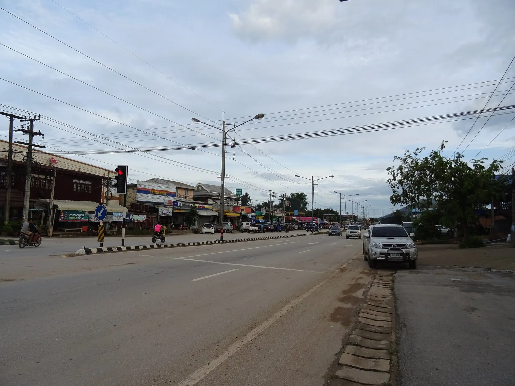
From Nong Khai, Highway 212 runs east and then south along the border: about 136km to Bueng Kan, roughly another 180km to Nakhon Phanom, and about 100km more to Mukdahan. It is a good, wide road with light traffic, but it is a transport route rather than a scenic one. The river appears in stretches and disappears for long periods behind embankments and plantations.
What is out there is worth the driving even so.
Bueng Kan is Thailand's newest province and its main draw is Wat Phu Tok, a sandstone outcrop rising out of flat farmland with a monastery built onto it and a series of wooden staircases and walkways pinned to the cliff faces, climbing seven levels. It is about an hour off the highway on local roads, and the walkways are exposed enough that anyone uneasy with heights should stop at level five.
Nakhon Phanom is the best town on the eastern section. It has a genuine riverside promenade — a rarity on the Thai Mekong — with the limestone mountains of Laos rising directly across the water, which makes for the most dramatic view of the river anywhere in Thailand. The Third Thai-Lao Friendship Bridge crosses here.
That Phanom, about 50km south, holds Phra That Phanom, one of the most venerated stupas in the country and the centre of a distinctly Lao-influenced religious tradition on both banks.
Mukdahan is the southern end: a border town with the Second Friendship Bridge to Savannakhet, a big Indochina market selling Vietnamese and Chinese goods, and Phu Pha Thoep national park south of town, where wind-eroded rock formations stand over a plain of wildflowers late in the wet season.
What the driving demands
Very little, technically. There are no mountains, no hairpins and no sustained gradients on the river road. Route 211 has some short climbs and a few tight bends where it goes round a bluff, and the access roads to the cliff temples are steep, but the main routes are easy.
The real considerations are different:
- Distance between everything. Bueng Kan to Nakhon Phanom is a two-and-a-half hour drive with essentially nothing in the middle. Fuel in towns, not in hope.
- Village main streets. Both roads run straight through settlements. Speed changes are signed and ignored by locals; markets spill onto the carriageway; children and dogs do not look.
- Agricultural traffic. Rubber and cassava lorries, and the ubiquitous two-wheeled walking tractors, at harvest.
- Border formality. You are driving along an international frontier. There are checkpoints, particularly near the bridges, and you should have your documents with you. See police checkpoints in Thailand.
- Night. The river road is unlit, unfenced, and used by unlit farm vehicles. Do your driving in daylight — see driving at night in Thailand.
Do not plan on crossing into Laos with your vehicle. There are four Friendship Bridges on this route and all of them will take a foot passenger or a bus passenger easily. Taking a Thai rental car or motorbike across is a different matter entirely and is prohibited by virtually every rental agreement in the country. See crossing into Laos by road and taking a rental vehicle out of Thailand.
Which vehicle
A car is the sensible default. The distances are long, the road is hot and exposed, and there is no technical driving to enjoy from a bike. Udon Thani is the practical place to rent — it has the region's main airport and the widest choice of hire desks. See car hire in Udon Thani and Isaan.
On a motorbike, Route 211 is a lovely ride and worth doing on anything from a 150cc upwards. The full 700km run to Mukdahan on a small scooter is a grind rather than a pleasure. Rental supply along the river is limited to the bigger towns, and the shops are geared to local customers rather than tourists.
When to go
November to February is the season, as it is everywhere in Isaan: cool, clear and dry, with morning mist on the river that is the whole reason Chiang Khan is photogenic. December and January mornings here are properly cold by Thai standards.
March to May is severe heat. The Mekong is at its lowest, which exposes sandbars and rock formations — some people come specifically for that — but a day of driving in this region in April is punishing.
June to October is the wet season. The river is high and brown and fast, the countryside is green, and local flooding closes short sections of riverside road most years. It is the most beautiful time to see the Mekong and the least convenient time to drive beside it. See the rainy season and flooded roads.
The Mekong road joins neatly onto other trips. At the western end, Chiang Khan is within reach of Loei's mountain country and the roads towards Phitsanulok. At the southern end, Mukdahan connects to the Isaan loop via Ubon Ratchathani. Nong Khai sits at the top of Highway 2, which is the fast way back to Bangkok.
A five-day version
Day one: Udon Thani to Nong Khai, an easy hour, with the afternoon at Sala Kaeo Ku sculpture park and the riverside.
Day two: Nong Khai east on Highway 212 to Bueng Kan, with the detour to Wat Phu Tok. About three hours of driving.
Day three: Bueng Kan to Nakhon Phanom, roughly three hours, arriving for the evening on the promenade.
Day four: Nakhon Phanom south to That Phanom and Mukdahan, a short day, or turn round and head back west.
Day five onward: the long return to Nong Khai and then Route 211 to Chiang Khan — which, if you have to choose, is the section to keep.
Frequently asked questions
Which part of the Mekong road actually follows the river?
Route 211 between Nong Khai and Chiang Khan, particularly the Sangkhom to Pak Chom stretch, where the road runs along the bank for long distances. Highway 212 east of Nong Khai is mostly set back inland with periodic glimpses, and the best river views on that side are from the towns rather than the road.
How long is the whole route?
About 700km from Chiang Khan to Mukdahan if you follow the border throughout. Four days is the minimum that is not exhausting; a week lets you stop properly.
Is Chiang Khan worth the drive?
Yes, if you want an atmospheric riverside town of old wooden shophouses and are not put off by it being a well-established Thai domestic destination. Go midweek and out of the cool-season peak and it is quiet.
Can I ride it on a scooter?
Route 211 on its own, comfortably, on a 150cc machine. The full route to Mukdahan involves several days of long, hot, straight highway that a small scooter is poorly suited to.
Do I need to worry about the border?
Not in terms of safety — this is ordinary rural Thailand. You should expect checkpoints near the Friendship Bridges and carry your licence, permit and rental documents. Crossing into Laos with a rental vehicle is a separate question, and the answer is generally no.
Where should I rent a car?
Udon Thani has the region's main airport and the best choice of hire desks; Nakhon Phanom, Nong Khai and Mukdahan have limited local options. Book ahead rather than turning up.
For the wider region, see driving in Isaan, and for the temples and national parks inland, the Isaan loop.