Highway 4 runs the length of Thailand's Andaman coast, from Ranong in the north to the far south, and driving it end to end is roughly 670km through five provinces. It is the best coastal road trip in the country: limestone towers, mangrove, rubber plantation, a tin-mining town, half a dozen national parks, and a road that keeps meeting the sea and then losing it again.
It is also the road that gets you to Khao Lak, Phang Nga and Krabi, which is why most people drive parts of it without ever thinking of it as a route. Given a week and a hire car, it is worth doing properly.
- DistanceAbout 670km, Ranong to Satun
- Time5-7 days to do it properly
- Main roadHighway 4 (Phetkasem) almost throughout
- Best seasonNovember to April
- Worst seasonMay to October, peaking in September
The route
| Leg | Roughly | What is there |
|---|---|---|
| Ranong - Khuraburi | 110km | Hot springs, mangrove, Surin Islands pier |
| Khuraburi - Takua Pa | 100km | Empty coast, old tin town |
| Takua Pa - Khao Lak | 30km | Beaches, tsunami memorial |
| Khao Lak - Phang Nga town | 70km | Karst country, Ao Phang Nga bay |
| Phang Nga - Krabi | 85km | Limestone, hot springs, Tiger Cave |
| Krabi - Trang | 130km | Rubber, caves, quiet beaches |
| Trang - Satun | 140km | Geopark, Pak Bara pier for Koh Lipe |
Highway 4 is Thailand's longest road, running more than 1,200km from Bangkok to the Malaysian border, and it changes character completely along its length. On this southern stretch it is mostly two lanes with intermittent four-lane sections, well surfaced, and busy with rubber and palm-oil lorries. See Highway 4: Phetkasem for the whole picture.
The northern half: Ranong to Khao Lak
Ranong is the wettest province in Thailand and looks it — steep green hills coming down to mangrove, with hot springs in the middle of town and a river border with Myanmar. It sees very few foreign visitors and is the quietest place on the whole route.
South of Ranong, Highway 4 runs about 110km to Khuraburi through a landscape of hills and estuaries with almost nothing on it. This is the emptiest driving on the Andaman coast and the part most people skip by flying into Phuket. Khuraburi is the departure point for the Surin Islands, which are among the best snorkelling in Thailand and closed during the monsoon.
Takua Pa is a former tin-mining town with a small Sino-Portuguese old town of shophouses that has been quietly restored. It is also the junction: Route 401 branches east here towards Khao Sok and Surat Thani, which is the crossing to the Gulf side — see Phuket to Khao Lak and Khao Sok.
Khao Lak is a 20km strip of beaches and resorts either side of Highway 4, backed by the forest of Khao Lak-Lam Ru national park. It was the worst-hit place in Thailand in the 2004 tsunami, and there are memorials along the road, including police boat 813, carried two kilometres inland and left where it stopped.
Take the old coast road where it exists
Highway 4 is the fast road and it sits inland. Around Khao Lak, Thai Mueang and again north of Krabi there are older, narrower parallel roads that run nearer the shore through villages and rubber. They are barely slower and they are where the trip actually happens.
The middle: Phang Nga and Krabi
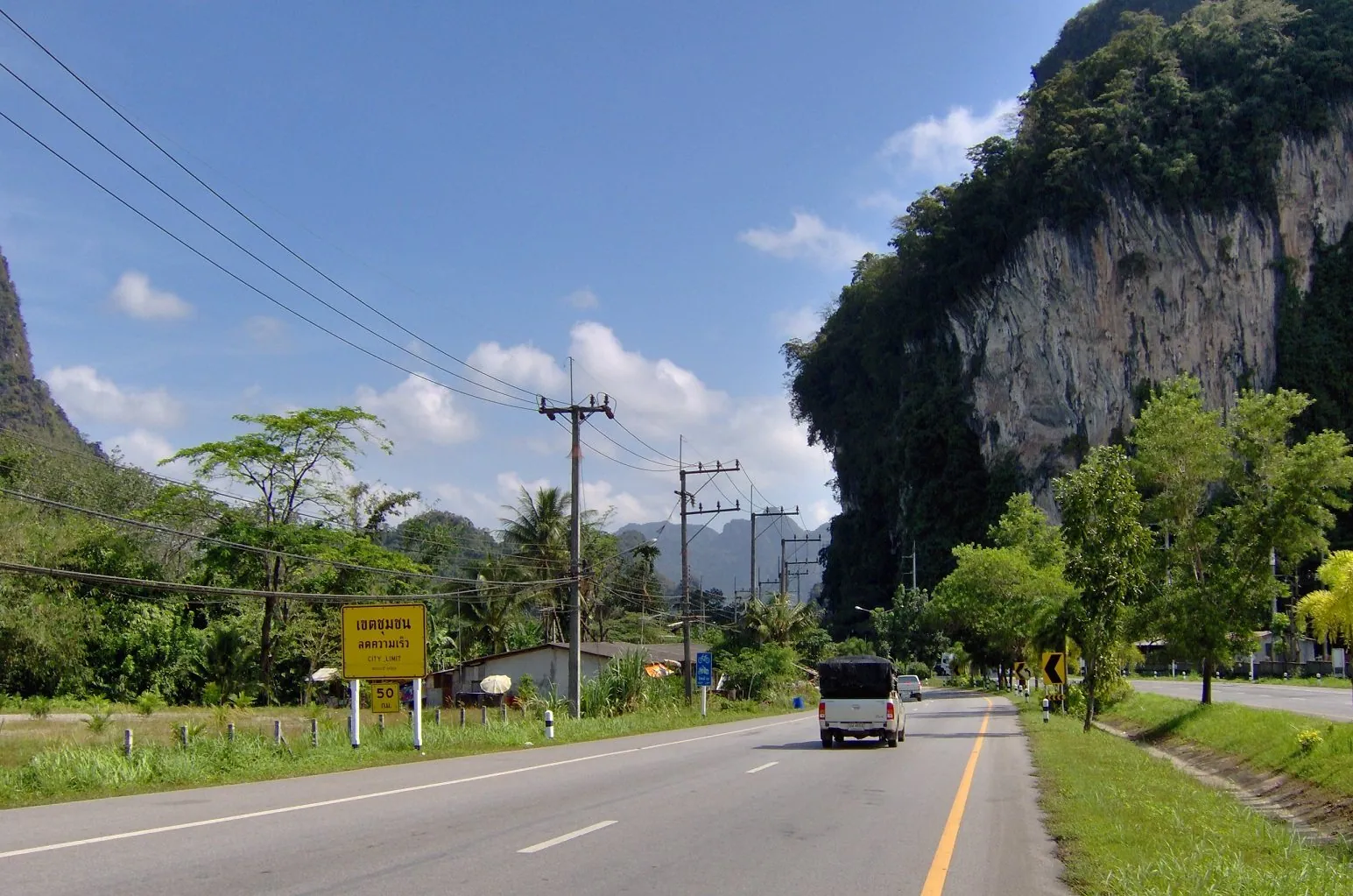
Between Khao Lak and Krabi the road enters proper karst country, and this is the most spectacular driving on the route. Limestone towers rise directly out of flat paddy and plantation on both sides of the highway, and around Phang Nga town the road threads between them.
Ao Phang Nga is the bay of sea stacks and hongs reached by boat from piers around Phang Nga town. Samet Nangshe, a viewpoint on a hill above the bay, gives you the whole thing from land — the access track is steep and rough enough that many visitors take a local pickup up rather than drive it.
Krabi is where the crowds start. Krabi town itself is a working river town; Ao Nang is the resort strip; Railay is a peninsula reachable only by longtail. Away from the beaches, Wat Tham Suea — the Tiger Cave Temple — has a staircase of well over a thousand steps to a summit shrine, and the Emerald Pool and hot springs at Khlong Thom, off Highway 4 south-east of Krabi, make a good half day.
Driving around Ao Nang and Krabi is the busiest part of the whole route: narrow resort roads, scooters everywhere, and coach traffic. See renting a scooter in Krabi and Ao Nang if you are picking up a bike here.
The southern half: Trang and Satun
South of Krabi the tourist traffic falls away sharply and the character changes again. Highway 4 runs through rubber and oil palm, the towns get smaller, and the Muslim proportion of the population rises.
Trang is a food town with a strong Chinese-Thai character, famous for its roast pork and its dim sum breakfasts. Its coast, at Hat Chao Mai national park and the beaches south of Sikao, is a quieter and cheaper version of Krabi's, and the offshore islands — Ko Muk with its Emerald Cave, Ko Kradan, Ko Libong with its dugongs — are reached by boat from small mainland piers.
Satun is the end of the road. The province is a UNESCO Global Geopark, built on some of the oldest exposed rock in Southeast Asia, and the pier at Pak Bara is the departure point for Tarutao National Marine Park and Koh Lipe — an island with no car roads at all, so if you are adding it to the trip see where to leave the vehicle at Pak Bara. The final section of the drive leaves Highway 4, which turns inland towards Phatthalung, and follows signed provincial roads south-west through Palian and La-ngu.
Several governments maintain travel advice covering the far southern provinces of Thailand. That advice names specific provinces and changes over time, and it has implications for travel insurance as well as safety. Check your own government's current advice before planning the southern end of this route, and see driving in the deep south and whether travel insurance covers driving in Thailand.
What the road demands
Highway 4 on the Andaman side is not a difficult road, but it is a working one. The specific issues:
- Rubber and palm-oil lorries. Heavily loaded, slow uphill, fast downhill, and often overtaking each other on a two-lane road. Give them room and do not sit in their blind spot. See buses and coaches on Thai roads.
- Rain, and a great deal of it. The Andaman coast takes the full southwest monsoon. Surface water on Highway 4 is common between May and October and the road drains badly in places.
- Hills between Ranong and Khuraburi. Not mountains, but sustained enough that slow lorries create long queues and dangerous overtakes.
- Resort-town chaos. Ao Nang, Khao Lak and the Krabi strip have far more scooters than the road was designed for, and a great many of them are ridden by visitors who have been on one for two days.
- Sand and gravel on the beach access roads. See sand and gravel on Thailand's coastal roads.
The Andaman coast has the worst monsoon in Thailand between May and October. Rainfall on this side builds from May and peaks around September. Boats to the offshore islands stop running, several national parks close for the season, and heavy rain on Highway 4 turns a straightforward drive into a slow one. The road itself stays open; what closes is everything you came to see.
Which vehicle
A car for the full route, without question. It is 670km of hot highway with long distances between anything, and the rain when it comes is torrential.
Motorbikes make sense locally rather than end to end. Base yourself in Khao Lak, Krabi or Trang and use a scooter for the beaches and the side roads, and you will have a far better time than you would riding Highway 4 all day. Phuket airport is the practical place to pick up a car for the northern half — see car hire in Khao Lak and airport car rental in Thailand.
When to go
November to April is the season, and the gap between it and the rest of the year is wider on this coast than anywhere else in the country. Dry, calm sea, all the boats running, all the parks open.
May to October is the southwest monsoon. It does not rain continuously — you can get good days in June — but the pattern is heavy and prolonged, the sea is rough, the island boats are suspended and the marine national parks close. If you are driving in these months, plan an itinerary that works from the mainland and treat any boat trip as a bonus.
The Gulf coast runs on the opposite calendar, with its wet season from October to December. If your dates are fixed and they fall in the Andaman monsoon, consider the Gulf coast drive instead.
A one-week version
Days one and two: fly into Phuket, cross the Sarasin Bridge and head north to Khao Lak. Beach, tsunami memorial, and the drive up to Takua Pa old town.
Day three: Khao Lak south to Phang Nga. Samet Nangshe viewpoint at dawn if you are willing, a boat into the bay if you are not.
Days four and five: Krabi. Tiger Cave Temple, the Emerald Pool, and a boat to Railay.
Days six and seven: south to Trang for the food and the quiet coast, and on to Satun if you have the extra day.
Reverse it, or run it northbound from Trang, and it works equally well. The single most common mistake is trying to add Khao Sok as a day trip — it is a full detour east on Route 401 and deserves two nights of its own.
Frequently asked questions
How long does the Andaman coast drive take?
About 670km from Ranong to Satun. Driven straight it is two long days. To see anything, allow five to seven, and expect to spend two of them not driving at all.
Where should I start?
Phuket airport is the easiest place to pick up a car and puts you in the middle of the route. Ranong or Surat Thani work if you want to drive the whole thing one way. Krabi airport is the alternative for the southern half.
Is Highway 4 a good road?
It is a well-surfaced national highway, mostly two lanes on this stretch, with heavy commercial traffic. It is not scenic in itself — the scenery is on the side roads — but it is easy driving.
Can I do it on a scooter?
Locally, yes, and it is a lovely place to ride short distances. End to end it is a poor idea: long hot highway days, heavy lorry traffic, and monsoon rain that arrives fast. Rent a car for the driving and a scooter where you stop.
What about the rainy season?
May to October, peaking around September, and it is a serious wet season on this coast. Boats stop, marine parks close, and the beaches are rough. The roads stay open. If your dates fall in those months, consider the Gulf coast instead.
Is it safe to drive to Satun?
Several governments issue travel advice covering parts of southern Thailand, naming specific provinces. That advice changes and should be checked directly rather than taken from any guide, including this one. It affects insurance validity as well as safety.
For the region generally, see driving in southern Thailand. For the island end of things, taking a car or motorbike on a Thai island ferry, and for Phuket itself, driving in Phuket.