Highway 4, known throughout its length as Phetkasem Road, is the longest road in Thailand: a little over 1,300 kilometres from Bangkok Yai on the Thonburi side of the Chao Phraya to the Malaysian frontier at Sadao. It runs through thirteen provinces, carries the Asian Highway 2 designation for most of its length, and is the only road number a driver needs to remember to get from the capital to the border.
That single number hides at least four different roads. Phetkasem is a congested six-lane city street in Bangkok, a fast divided highway down the gulf coast, a mountain road over the isthmus at Ranong, and a strip of small-town commerce through the far south. Judging the whole thing by the bit you have driven is the standard mistake.
- LengthAbout 1,310 km
- FromBangkok Yai district, Bangkok
- ToThe Malaysian border at Sadao, Songkhla
- Provinces13, from Samut Sakhon to Songkhla
Where it actually goes
| Stage | Through | What it is like |
|---|---|---|
| Bangkok to Ratchaburi | Nakhon Pathom | Urban, then commercial ribbon. Slow. |
| Ratchaburi to Chumphon | Phetchaburi, Cha-am, Hua Hin, Prachuap Khiri Khan | Fast four-lane, sea on the left in places |
| Chumphon to Ranong | Kra Buri | Crosses the isthmus. Hills, rain, forest |
| Ranong to Krabi | Takua Pa, Khao Lak, Phang Nga | The best stretch. Limestone and coast |
| Krabi to Sadao | Trang, Phatthalung, Hat Yai | Inland, busy, plantation country |
Bangkok to Phetchaburi: the part nobody enjoys
Phetkasem leaves Bangkok through Phasi Charoen, Bang Khae and Nong Khaem — dense, slow, endlessly interrupted by traffic lights and U-turn bridges, with motorbikes filling every gap. It improves after Nakhon Pathom but never becomes a pleasant road: this is a corridor of factories, tyre shops, wedding-dress showrooms and enormous roadside restaurants, with vehicles turning across the carriageway at every kilometre.
Almost nobody heading south actually drives this section. The alternative is Highway 35, the Rama II Road, which leaves Bangkok through Samut Sakhon and rejoins Highway 4 in Ratchaburi province — shorter, faster, and for years a construction site for its elevated replacement. Which of the two to use on any given weekend is the subject of our guide to driving Bangkok to Hua Hin.
The gulf coast run
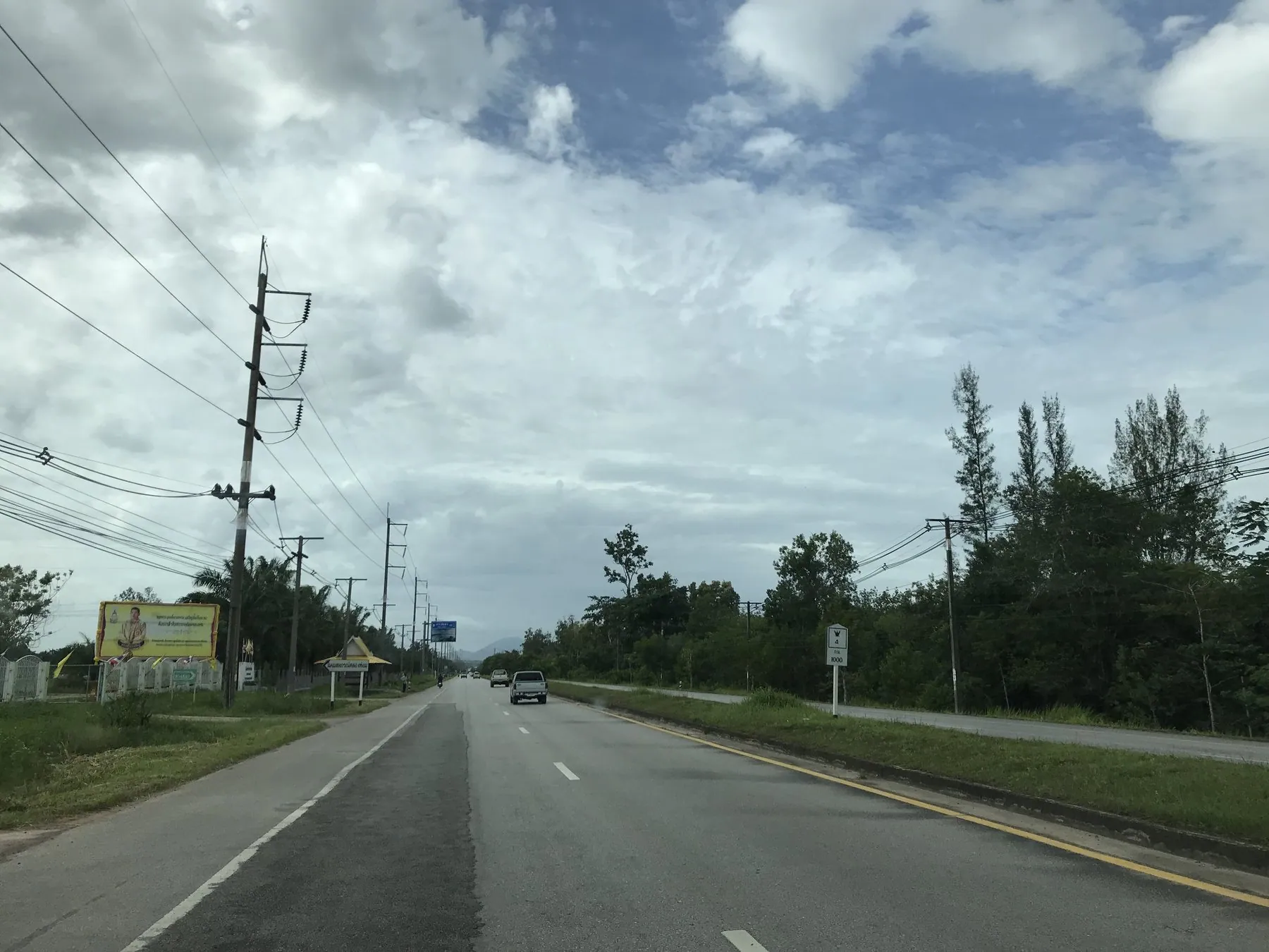
South of Phetchaburi, Highway 4 becomes the road most visitors picture: four lanes, a solid central reservation, generous shoulders, and long enough sight lines to see trouble coming. It passes Cha-am and Hua Hin, then squeezes down the narrow shelf of Prachuap Khiri Khan between the hills and the sea, with Myanmar only a few tens of kilometres to the west for much of the way.
This is easy, fast driving by Thai standards. The hazards are dull ones: lorries pulling out without looking, the endless U-turn gaps in the central reservation where local traffic crosses, and long straight sections that induce exactly the kind of inattention covered in fatigue on long drives. Big branded forecourts appear every twenty or thirty kilometres and make decent stopping points; see service areas and rest stops on Thai highways. The scenic detours off it are the subject of the gulf coast drive from Hua Hin to Surat Thani.
Chumphon, and the fork that matters
At Chumphon the road makes its one big decision. Highway 4 turns west, crosses the isthmus and comes out on the Andaman side at Ranong. Highway 41 carries straight on down the middle of the peninsula through Surat Thani and Nakhon Si Thammarat, which is the fast way to the Samui ferries and to the deep south.
Get this wrong and you will add several hours. If your destination is Phuket, Khao Lak or Krabi, follow Highway 4. If it is Surat Thani, Nakhon Si Thammarat or Hat Yai, take Highway 41. Navigation apps handle the choice well, but the road signs at the junction are worth reading anyway — see how Thai highway numbering works.
Ranong: the wet bit
The crossing of the isthmus at Kra Buri is the most interesting driving on the whole road and the least forgiving. Highway 4 climbs into forested hills, follows the Kraburi River that marks the Burmese border, and drops down to Ranong town. Ranong is the wettest province in Thailand and it shows: the surface stays damp for months, the drainage struggles, and afternoon storms in the monsoon reduce visibility to almost nothing. Read the rainy season and flooded roads before driving this stretch between roughly May and October.
Standing water and heavy lorries are a bad combination. The Chumphon to Ranong section carries a lot of freight over a road that climbs and descends repeatedly. Give lorries room on the downhills, do not overtake into a bend you cannot see through, and if a storm arrives, use one of the roadside restaurants and wait it out. Thai drivers do exactly that.
The Andaman stretch: the good part
From Ranong south, Highway 4 becomes one of the more enjoyable long-distance drives in the country. It runs behind the coast through Takua Pa and Khao Lak, past the turning for the Sarasin Bridge onto Phuket, then swings inland through Phang Nga town where limestone karsts rise straight out of the paddy on both sides of the carriageway. Between Phang Nga and Krabi it is a genuinely beautiful road, and one of the few places in Thailand where you will want to stop for the view rather than for a toilet.
This section is covered in detail in the Andaman coast road trip, and the Phuket end of it in Phuket to Khao Lak and Khao Sok.
Krabi to the border
After Krabi, Highway 4 turns inland and loses the coast for good. Through Trang and Phatthalung it becomes a working road through rubber and palm-oil country: heavy lorries, plantation traffic, small towns strung along the carriageway, and a lot of vehicles joining from side roads without much of a look. It reaches Hat Yai, the commercial capital of the south, and finally Sadao, where a new permanent border complex opened in 2026 opposite Malaysia's Bukit Kayu Hitam.
Two things to know about this end of the road. It is the busiest freight corridor in southern Thailand, and it passes close to the provinces covered by the deep south travel advisories — Highway 4 itself runs through Songkhla province to the west of the advised-against districts, but the roads branching east from it do not. If you are crossing, read crossing into Malaysia by road first, and note that a hire car almost certainly may not go with you.
Driving it end to end
It can be done in two long days and should not be. Three days gives you time to break at Prachuap or Chumphon and again around Krabi, and to drive the Ranong hills in daylight rather than at dusk. Night driving on Phetkasem is not recommended: the road has unlit sections, unmarked hazards, and vehicles without working rear lights, all covered in driving at night in Thailand.
Frequently asked questions
How long is Highway 4?
About 1,310 kilometres, making it the longest highway in Thailand. It runs from Bangkok to the Malaysian border at Sadao in Songkhla province.
Is Highway 4 a toll road?
No. Phetkasem Road is free for its entire length. Tolls in Thailand are almost entirely confined to the Bangkok expressway and motorway networks.
Is Highway 4 dual carriageway all the way?
No. Long sections are four-lane divided, particularly down the gulf coast, but the isthmus crossing at Ranong and parts of the far south narrow to two lanes with overtaking on the opposite side of the road.
Should I take Highway 4 or Highway 41 south of Chumphon?
Highway 4 for the Andaman side — Ranong, Khao Lak, Phuket, Krabi. Highway 41 for the gulf side and the fast run to Surat Thani, Nakhon Si Thammarat and Hat Yai. Highway 41 is the quicker road; Highway 4 is by far the better one.
Can I ride a motorbike on Highway 4?
Yes. It is an ordinary public highway, not an expressway, so motorbikes are permitted along its whole length. Whether a 125cc rental scooter is the right machine for a thousand kilometres of it is another question — see driving in southern Thailand.
Where does Highway 4 start in Bangkok?
At the Naowa Chamnian bridge in Bangkok Yai district, on the Thonburi side of the river, then west through Phasi Charoen and Bang Khae. Most drivers heading south pick it up much further out, or use Highway 35 instead.