The single most useful skill for planning a bike route in Thailand is reading the road numbers. The Thai highway network is numbered by importance, and the number of digits tells you almost everything you need to know: one and two digits mean fast, busy national and regional highways you want to avoid; four digits mean small local roads that are sealed, quiet and go almost everywhere. Plan on four-digit roads and Thailand becomes a good cycling country.
This is written for anyone building their own route — the tourer plotting a fortnight, or the day-hirer working out how to get from a guesthouse to a waterfall without riding on a dual carriageway. It assumes you will use a mapping tool, and it explains what the tool will not tell you.
- 1–2 digit roadsNational and regional highways — avoid
- 3 digit roadsSecondary. Usable, sometimes busy
- 4 digit roadsLocal. The good ones
- First digitTells you the region
How Thai road numbers work
The Department of Highways numbers its network on a simple logic. The four single-digit routes are the national spines: Highway 1 (Phahonyothin) north, Highway 2 (Mittraphap) northeast, Highway 3 (Sukhumvit) east and southeast, and Highway 4 (Phetkasem) south. After that, the first digit of any number tells you which of those regions you are in — a road beginning with 1 is in the north, 2 in the northeast, 3 in the centre and east, 4 in the south — and the number of digits tells you how important the road is.
| Digits | Type | What it means on a bicycle |
|---|---|---|
| 1 | National spine | Multi-lane, heavy freight, fast. Ridable on the shoulder, unpleasant. Avoid where possible |
| 2 | Regional highway | Usually two lanes each way with a good shoulder. Fast traffic. The default long-distance option and the one to escape from |
| 3 | Secondary highway | Varies enormously. Some are quiet and lovely, some are busy links between towns |
| 4 | Local highway | What you want. Sealed, single carriageway, light traffic, passing through villages |
Beyond the Department of Highways network there is a second system of rural roads, signed with a provincial abbreviation in Thai script followed by a number. These are the smallest sealed roads — often superb for cycling, occasionally deteriorating into gravel without warning. They are not always well represented on foreign mapping apps.
Tolled expressways and motorways are a separate category entirely and are closed to bicycles. See Thai highway numbers and distance signs decoded for the full system, and Thailand's expressways and motorways for what the toll network covers.
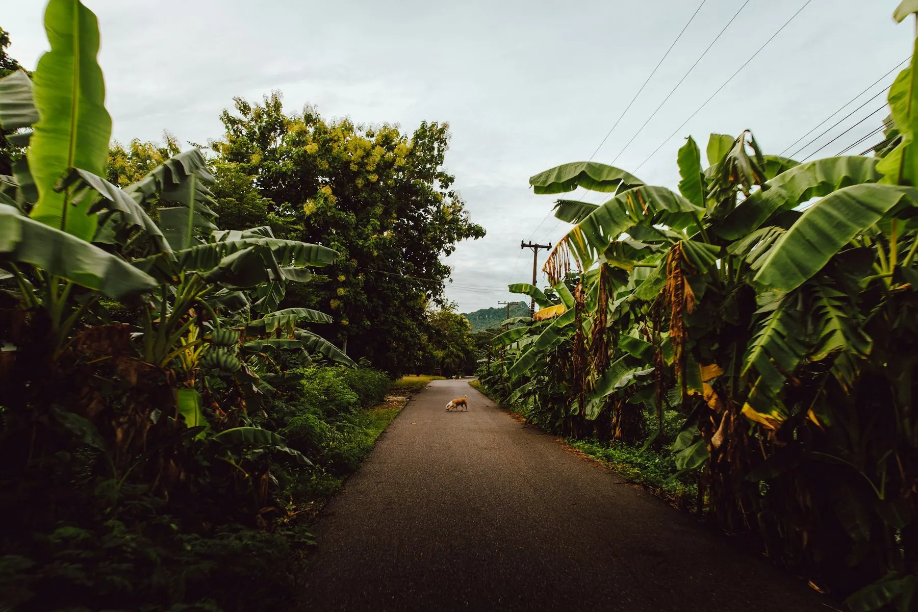
The single planning habit worth adopting: when your routing app puts you on a two-digit highway, look for a four-digit road running parallel. There almost always is one, it usually adds ten to twenty per cent to the distance, and it removes every lorry. That trade is worth making almost every time.
Why routing apps get Thailand wrong
Automated bicycle routing here produces two characteristic failures. The first is that it sends you down the fastest sealed road, because the road data does not know that Highway 11 is a horrible place to be on a bicycle and the parallel 1015 is a delight. The second is that it sends you down tracks that are not roads at all — Thai map data is full of field paths, irrigation embankments and unsurfaced tracks tagged as roads, and following one of those with 20 kilograms of luggage in the wet season is a long afternoon.
The fix is to route by hand and verify by satellite. Draw your line along the road numbers you want, then drop into satellite view and check every segment you do not recognise. You are looking for: is it sealed, does it actually connect, and is there anything on it — a village, a shop, a temple — to stop at.
- Route manually on four-digit roads rather than accepting an automatic suggestion
- Check every unfamiliar segment in satellite view before committing to it
- Look for the shadow of a sealed surface: a crisp edge and a consistent width
- Verify that river crossings exist — a road on both banks does not mean a bridge
- Download offline maps for the whole region; rural mobile coverage is good but not universal
- Export a GPX and carry it on a device that does not depend on data
Which apps actually work in Thailand, and their quirks, is covered in navigation apps in Thailand.
Planning around water and shade
In Thailand, water is not the constraint people expect. Roadside shops with fridges appear every few kilometres across most of the country, and there are very few stretches where you need to carry more than a couple of litres. What you do need to identify in advance are the exceptions: long mountain climbs with nothing on them, the emptier stretches of national park road, and the sections of Isaan and the far south where villages thin out.
Shade is the underrated planning variable. A route through plantation and forest is a different experience from the same distance across open rice plain, and in the hot season it is the difference between a pleasant morning and heat exhaustion. Satellite view tells you this immediately: tree cover along the road edge is visible, and it is worth choosing a route for it. Rubber plantations in the south, teak and mixed forest in the north, and the sugar and cassava country of Isaan in that order from best to worst.
Build the day around a finish before dark, not around a distance. Sunset in Thailand comes at much the same time all year and there is very little twilight. The routing consequence is that a stage should end with a town on it by mid-afternoon, with a fallback town twenty kilometres earlier. Riding Thai roads after dark is the single biggest avoidable risk a cyclist takes here — see driving at night in Thailand.
Stage lengths that work
Reduce whatever you would ride at home. In the cool season on flat terrain, a loaded rider might comfortably do 90 to 110 kilometres. In the hot season, or in the northern hills, halve it. The riding day here is effectively first light to about 11:00 with an optional late-afternoon leg, which is a much shorter working window than a European summer gives you — the reasoning is in cycling in Thailand's heat and humidity.
Accommodation is rarely the limiting factor. Any Thai town with a district office has somewhere to sleep, usually cheap and usually available without booking outside the December–January peak. That means you can plan loosely and adjust on the day, which is a genuine luxury and one of the reasons Thailand is a forgiving country to tour.
Choosing the region
| If you want | Go |
|---|---|
| Easy first tour, flat, quiet | Isaan — the Mekong road and the four-digit network behind it |
| Climbing | The north — Chiang Mai, Mae Hong Son, Nan |
| A defined multi-day loop | The Mae Hong Son loop |
| Short rides between beaches | Selected islands — see cycling on Thailand's islands |
| Culture at cycling pace | Sukhothai, Si Satchanalai, Ayutthaya, the Khmer temples of southern Isaan |
| A city ride | Bang Krachao or the Sky Lane |
Two regions to think about carefully. The far south — Yala, Pattani and Narathiwat — is subject to standing travel advice from several governments, and the position is set out in driving in the deep south; check your own government's advice before routing through it. And the corridor between Bangkok and the coast is the busiest, least pleasant riding in the country, best skipped by train.
Building in the escape routes
Plan how you would get out. Thailand makes this easy — buses run everywhere and will generally take a bicycle in the luggage bay, trains on the main lines carry bikes in the freight car, and songthaews will put one on the roof. Knowing that the next town has a bus station means you can commit to a hard stage without committing to finishing it. See taking a bike on Thai trains and buses.
Similarly, know where the hospitals are. Every district town has one, provincial capitals have good ones, and the distinction matters if something goes wrong — Thai hospitals and what treatment costs explains the tiers. Keep emergency numbers saved offline.
Frequently asked questions
What do Thai road numbers mean for cyclists?
Fewer digits means a bigger, faster road. One- and two-digit routes are national and regional highways; four-digit routes are local roads. Plan on four-digit roads wherever they exist and the traffic problem largely disappears.
Can I use Google Maps or Komoot to plan a route in Thailand?
For drawing and exporting, yes. For automatic bicycle routing, treat the output with suspicion — it will put you on highways because they are fast, and occasionally on field tracks that are not roads. Verify unfamiliar segments in satellite view.
How far should I plan to ride each day?
In the cool season on flat ground, 90 to 110 kilometres loaded is comfortable. In the hot season, or in the hills, plan half that. The constraint is the length of the usable riding window, not your legs.
Do I need to book accommodation in advance?
Rarely, outside the December to January peak and the Songkran and New Year periods. Any Thai town of district size has somewhere to sleep. This is what makes flexible, adjust-on-the-day touring possible here.
Is it worth carrying a GPS device rather than using a phone?
A phone works and coverage is good, but heat and rain are hard on them, and a phone that has cooked in a handlebar mount at midday will not navigate. Whatever you use, download offline maps and carry a paper backup of the road numbers for your route.
Which roads should I definitely avoid on a bicycle?
Tolled expressways and motorways, where bicycles are not permitted at all — see bicycle law in Thailand. Beyond that, Highways 1, 2, 3 and 4 for any length, the ring roads around Bangkok and Chiang Mai, and the Rama II corridor south of Bangkok.