The Golden Triangle loop out of Chiang Rai is around 250km of driving that takes in a Yunnanese tea village at 1,200 metres, a royal villa on a forested peak, Thailand's northernmost border town and the point where the Mekong divides Thailand, Laos and Myanmar. Two days is enough. Three is better, because the roads in this corner are more interesting than the sights and rushing them wastes both.
Unlike the Mae Hong Son Loop, this is not one continuous mountain road. It is a series of climbs and descents linked by fast, flat, dual-carriageway sections of Highway 1. That makes it a much softer proposition for a nervous rider or a first-time driver — you can take the hills at your own pace and then relax on the main road afterwards.
- DistanceAbout 250km round trip
- Time2 days minimum, 3 comfortable
- Main roads1, 1089, 1130, 1149, 1290, 1016
- Best seasonNovember to February
- Vehicle150cc+ scooter or any car
The loop in order
The standard circuit runs anticlockwise from Chiang Rai: north on Highway 1, west and up to Mae Salong, back down and north to Doi Tung, on to Mae Sai on the Myanmar border, east along the Mekong to Sop Ruak and Chiang Saen, then south-west back to Chiang Rai.
| Leg | Roads | Distance | Character |
|---|---|---|---|
| Chiang Rai - Mae Chan | 1 (Phahonyothin) | about 30km | Fast dual carriageway |
| Mae Chan - Mae Salong | 1089 then 1130 | about 35km | Sustained climb, tight bends |
| Mae Salong - Ban Huai Khrai | 1130 / 1234 then 1 | about 45km | Descent, then main road |
| Ban Huai Khrai - Doi Tung | 1149 | about 15km up | Steep, narrow, hairpins |
| Doi Tung - Mae Sai | 1149 then 1 | about 30km | Descent, then border town |
| Mae Sai - Sop Ruak | 1290 | about 30km | Rolling, riverside, easy |
| Sop Ruak - Chiang Saen | 1290 | about 10km | Flat, along the Mekong |
| Chiang Saen - Chiang Rai | 1016 then 1 | about 60km | Flat and fast |
Mae Salong: the climb that matters
Doi Mae Salong, officially Santikhiri, is a ridge-top village founded by soldiers of the defeated Chinese Nationalist 93rd Division who crossed out of Burma in the 1960s. It still feels Chinese: Yunnanese noodle shops, tea plantations on the slopes, Mandarin on the signage alongside Thai.
Getting there is the good part. From Mae Chan you turn onto Route 1089, then onto Route 1130, and the road climbs steadily for around 30km through tea terraces to about 1,200 metres. It is a well-surfaced two-lane road with continuous corners and some serious drops, and it is quiet. Route 1234 provides a second, newer approach from the south — the two together make up what people mean when they talk about the Mae Salong road.
The climb is long enough to matter mechanically. On a 110cc scooter with a passenger you will be crawling in places and the engine will be hot at the top. On the way back down, the descent is where brakes fade — go down through the gears or let the automatic hold you, rather than dragging the lever for twenty minutes. Our guide to mountain roads and hairpin bends covers the technique.
Stay the night at the top
Mae Salong is the best overnight stop on the loop and most people drive straight through it. The village sits above the cloud layer often enough that the early morning view over the valleys is the single best thing on this trip, and it happens at about six in the morning when the day-trippers are still in Chiang Rai.
Doi Tung: the steepest road on the loop
From Highway 1 at Ban Huai Khrai, about 42km north of Chiang Rai, Route 1149 turns off and climbs to the Doi Tung Royal Villa and the Mae Fah Luang Garden. The villa was the late Princess Mother's mountain home and the whole estate is part of a development project that replaced opium cultivation with coffee, macadamia and horticulture.
Route 1149 is the sharpest gradient on this circuit. It is narrow, it hairpins tightly, and it climbs about 15km to the villa. Tour buses use it, which means you will meet a coach on a blind bend at some point. There are separate admission charges for the villa, the garden and the arboretum, and you can buy them individually or together at the gate.
Beyond the villa the 1149 continues along the ridge towards Mae Sai past the arboretum and the hill villages, and this continuation is the better ride. It is narrower again, largely empty, and drops you close to the border.
The ridge roads north of Doi Tung run within a few hundred metres of the Myanmar border in places. Signage is thin, some side tracks lead to army checkpoints, and a wrong turn can put you somewhere you should not be. Stay on numbered roads, carry your documents, and do not take an unsigned track because a map application suggests it.
Mae Sai and the border
Mae Sai is Thailand's northernmost town and consists largely of a market street running down to the bridge over the Sai river into Tachileik, Myanmar. The crossing itself is subject to closures and restrictions that change without much notice, and it is not somewhere to arrive with a plan that depends on getting across. As a place to eat lunch and look at the northernmost point marker, it is fine.
Driving in Mae Sai is the busiest few kilometres of the loop: market traffic, delivery pickups, and cross-border trade lorries in a narrow street. Park and walk. If you are considering taking a vehicle across a land border anywhere in Thailand, read can you take a rental vehicle out of Thailand first — the answer is usually no.
The Mekong: Sop Ruak and Chiang Saen
Route 1290 runs east from Mae Sai to the river and then along it. This is the easiest driving of the whole loop, and it is genuinely pretty: rolling road through pineapple and rubber, then the Mekong itself.
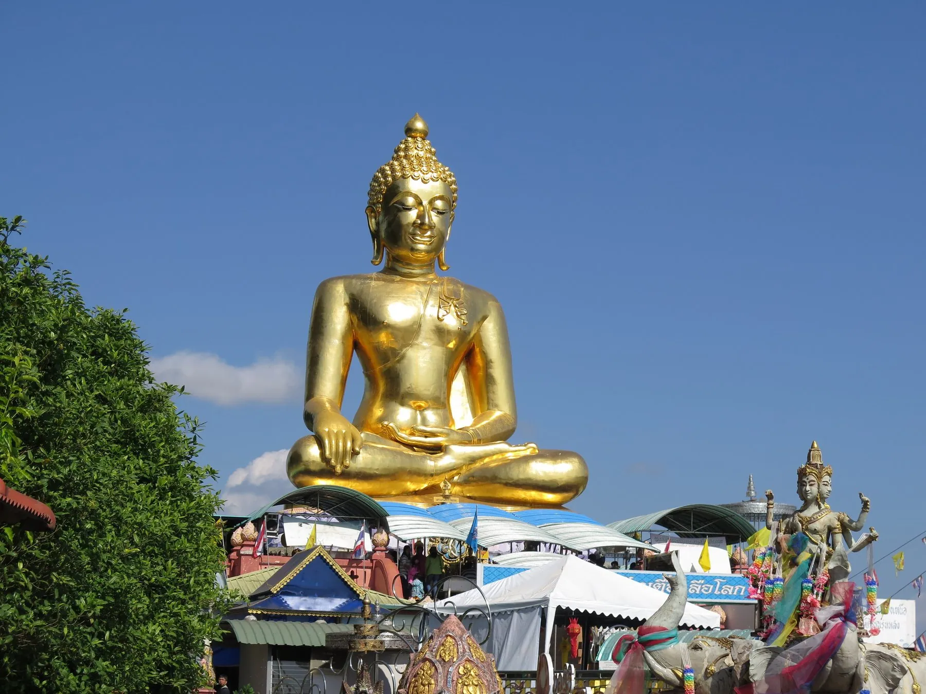
Sop Ruak is the actual Golden Triangle — the confluence where the Ruak river joins the Mekong and Thailand, Laos and Myanmar meet. It has been developed into a viewpoint with a giant Buddha, a lot of souvenir stalls and two opium museums, of which the Hall of Opium on the hill is the serious one and well worth an hour.
Chiang Saen, 10km further on, is the reason to keep driving. It is an old Lanna city on the riverbank, with ruined chedis standing in among ordinary houses, a quiet riverside road and none of Sop Ruak's coach parties. It is the better place to stay the second night.
From Chiang Saen, Route 1016 runs back west to Mae Chan and Highway 1 takes you into Chiang Rai — about an hour of flat, fast, dull road. If you have another day, the alternative is to turn east instead and follow the river towards Chiang Khong, which is the start of the Mekong river road.
Which vehicle, and when to go
A 125cc scooter will do this loop more comfortably than it will do Mae Hong Son, because the hard sections are shorter and there is plenty of flat road in between. A 150cc or larger machine still makes the Mae Salong and Doi Tung climbs more pleasant, particularly two-up. Chiang Rai's rental market is much smaller than Chiang Mai's — see renting a motorbike in Chiang Rai — so if you want anything specific, arrange it before you arrive or rent in Chiang Mai and ride across on Highway 118.
In a car it is straightforward. Both mountain roads are sealed and two-lane; the 1149 is narrow enough that you will be reversing to a passing place if you meet a coach badly, but nothing worse.
November to February is the season. Clear air, dry roads, and mornings at Mae Salong cold enough to want a jacket. March and April bring the burning season, and this corner of Thailand sits downwind of a great deal of agricultural fire on both sides of the border; the views that justify the drive simply are not there. May to October is wet, and the two mountain roads become slippery and occasionally scattered with debris after a storm, but the loop remains drivable with care.
Chiang Rai itself is a small city that takes ten minutes to cross, which makes it an unusually easy base — everything on this loop is within about ninety minutes of the centre. See driving in Chiang Rai.
A two-day and a three-day version
Two days. Day one: Chiang Rai to Mae Chan, up to Mae Salong, lunch, down and up Route 1149 to Doi Tung, then to Mae Sai for the night. Day two: Route 1290 along the river to Sop Ruak and Chiang Saen, then Route 1016 and Highway 1 back to Chiang Rai by mid-afternoon.
Three days. Night one at Mae Salong, night two at Chiang Saen. This gives you the mountain morning at the top of the tea terraces and the Mekong evening at the old city, which are the two best hours of the trip, and it means neither day involves more than about four hours of driving.
Frequently asked questions
How long does the Golden Triangle loop take?
About 250km in total, which is two comfortable days of driving or three relaxed ones. It can be compressed into a single very long day from Chiang Rai, and organised day tours do exactly that, but you will spend it in the vehicle.
Is Sop Ruak worth going to?
The viewpoint itself is a tourist stop with stalls and a large Buddha, and takes twenty minutes. The Hall of Opium museum on the hill above is genuinely good and takes an hour or two. Chiang Saen, ten kilometres further along the river, is the more rewarding place to spend time.
Can I cross into Myanmar or Laos on this trip?
Not casually, and not in a rental vehicle. Border conditions at Mae Sai change frequently and should be checked against current official advice immediately before you travel. Taking a hire car or bike across any Thai land border is almost always prohibited by the rental agreement — see crossing into Laos by road for what is actually involved.
Is a 125cc scooter enough for Mae Salong and Doi Tung?
Solo, yes, though you will be slow on the climbs. Two-up with luggage, both roads are hard work and the descents ask a lot of small brakes. A 150cc machine is a worthwhile upgrade for this loop.
Where should I stay?
Mae Salong for the mountain morning and Chiang Saen for the river. Mae Sai is convenient but not attractive. Chiang Rai has by far the widest choice and works fine as a single base if you would rather not move your luggage.
Is it safe to drive near the border?
The tourist route is entirely ordinary driving. The caution is about navigation rather than danger: stay on numbered highways, do not follow unsigned tracks towards the frontier, and keep your documents with you because there are checkpoints on Highway 1 north of Chiang Rai. See police checkpoints in Thailand.
Onward from here: Route 1148 and the northern back roads starts within reach of Chiang Rai and is the finest single road in Thailand, and the Mekong river road continues downstream. For the wider region, see driving in northern Thailand.