The Mae Hong Son Loop is a circuit of roughly 600km through the mountains west and north of Chiang Mai, made up of just two road numbers for almost its entire length: Route 1095 up over the ridge to Pai and Mae Hong Son, and Route 108 back down the Salween side through Mae Sariang and Hot. It is the best sustained driving and riding in Thailand, and it is genuinely demanding — not because the surface is bad, but because it almost never stops turning.
Four days is the minimum that makes sense. Five or six is the version people come back raving about. Doing it in three means spending the whole trip looking at tarmac rather than at the country the road was built to reach.
- Total distanceAbout 600km
- Realistic time4 days minimum, 5-6 better
- Best seasonNovember to February
- Worst seasonMarch-April (haze), Aug-Sept (rain)
- Vehicle150cc+ scooter, any bike, or a car
The route, leg by leg
From Chiang Mai you head north on Route 107 (Chotana Road) for about 35km to Mae Malai, where Route 1095 begins. From there the loop is anticlockwise: 1095 all the way to Mae Hong Son, then Route 108 south and east back to Chiang Mai. You can run it the other way round, and there is a case for it, which is covered below.
| Leg | Road | Distance | Driving time |
|---|---|---|---|
| Chiang Mai - Pai | 107 then 1095 | about 135km | 3-3.5 hours |
| Pai - Pang Mapha (Soppong) | 1095 | about 44km | 1 hour |
| Pang Mapha - Mae Hong Son | 1095 | about 67km | 1.5 hours |
| Mae Hong Son - Khun Yuam | 108 | about 65km | 1.5 hours |
| Khun Yuam - Mae La Noi | 108 | about 67km | 1.5 hours |
| Mae La Noi - Mae Sariang | 108 | about 30km | 30 minutes |
| Mae Sariang - Chiang Mai | 108 via Hot | about 190km | 3.5-4 hours |
Those times assume you stop for nothing; add photographs, coffee and lunch and every leg roughly doubles. The Mae Sariang to Chiang Mai run is the longest day on the loop and the one people most often underestimate, because it looks flat on a map and is not: the road climbs and drops repeatedly for the first hundred kilometres before releasing you onto the plain at Hot.
How many bends, really
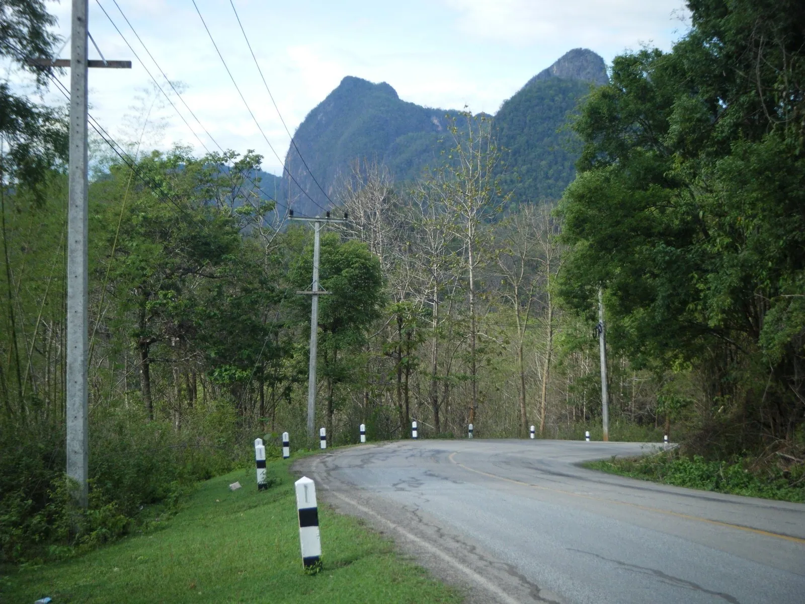
Mae Hong Son sells itself on 1,864 curves, painted on signs, T-shirts and half the guesthouses in town. The number refers to Route 108, the southern arm of the loop via Mae Sariang. The northern arm, Route 1095 between Chiang Mai and Pai, is credited with 762 bends over 135km — a corner roughly every 175 metres, for three hours.
Nobody has audited either figure and it does not matter. What matters is the consequence: you are cornering almost continuously, in heat, often on a vehicle you have owned for two days. Fatigue arrives much earlier than the distance suggests. Treat a 150km day here as equivalent to a 400km day at home and you will have the pace about right.
What the road actually demands
The surface is good. Route 1095 and Route 108 are both properly engineered two-lane national highways, resurfaced regularly, with guardrail on the worst drops and reasonable signage. This is not a dirt-track adventure. The difficulty is entirely in the geometry.
Three things catch visitors out:
- Blind, decreasing-radius hairpins. Many bends tighten as you go through them and a good number are blind over a crest. What is coming is frequently a minibus using both lanes.
- Gradient on the descents. Long downhill sections will boil the brakes on a small scooter ridden on the lever alone. Use the engine, and go down a gear before the hill rather than during it.
- Gravel and leaf litter on the apex. After rain, and when farm trucks spill their loads, the outside of a bend collects a stripe of grit. It is the most common way visitors go down here — see mountain roads and hairpin bends.
The Chiang Mai to Pai minibuses are the hazard everyone remembers. They run the 1095 on a schedule that does not really allow for the road, and they overtake into bends. Assume that anything coming the other way on a blind left-hander is partly on your side of the road, and position yourself wide accordingly.
Which vehicle
A 110cc or 125cc automatic scooter — the class of machine every rental shop hands out — will physically complete the loop, and thousands do every year. But it is slow up the long climbs, hard-pressed two-up with luggage, and its small wheels are less forgiving of the gravel patches. If there are two of you, go bigger.
The sweet spot is a 150cc to 300cc machine with proper wheels and brakes. Chiang Mai has the best selection in the country and the good shops book out in high season, so read renting a motorbike in Chiang Mai before you turn up. Renting a big bike is straightforward in Chiang Mai and almost impossible in Mae Hong Son.
A car is not a cop-out. The views are the same and it removes the two things that ruin the trip for many people: rain and luggage. A small automatic is fine — see automatic or manual.
The one-way trick
You do not have to ride the whole loop. Mae Hong Son and Pai both have small airports with flights to Chiang Mai, and Chiang Mai rental firms will occasionally arrange a one-way drop for a fee. Riding the 1095 out to Mae Hong Son and flying back is a legitimate way to see the best half of the road with half the fatigue.
Where to break the journey
Pai is the obvious first night and most people stop there. It is a small valley town that has been thoroughly discovered — walking street, coffee, hostels — but the setting is lovely and the surrounding roads are good. Two nights lets you ride out to Pai Canyon, the hot springs and Ban Santichon without moving your luggage.
Pang Mapha, usually still called Soppong, is 44km further on: the quiet alternative to Pai, a strip of a village near the Tham Lod cave system, which you enter by bamboo raft with a lantern-carrying guide.
Mae Hong Son is the far corner of the loop and deserves two nights. The town sits in a bowl of hills around Nong Chong Kham lake with two Burmese-style temples on the shore, and the morning mist that fills the valley is why the province is nicknamed the city of three mists. The road out to Ban Rak Thai, a Yunnanese tea village on the Myanmar border, is a superb half-day return trip.
Khun Yuam is a modest one-street town with an unexpectedly good small museum about the Japanese army's retreat through here in 1945.
Mae Sariang sits on the Yuam river close to the Salween and is the natural last night: unglamorous, cheap and pleasant, and it splits the long final leg into something manageable.
When to go, and when not to
November to February is the season. Dry, clear, cool enough in the mornings at altitude that you will want a jacket — genuinely cold on the Mae Hong Son to Khun Yuam stretch before about nine in the morning. This is also peak tourist season, so book Pai and Mae Hong Son ahead.
March and April are the burning season and this is the single biggest planning mistake visitors make. Farmers across the north clear crop residue by fire, the mountains trap the smoke, and Chiang Mai regularly records some of the worst air quality of any city in the world during those weeks. Visibility on the loop can drop to a few hundred metres and the views vanish entirely. Fire activity peaks in March and fades as the first rains arrive.
May to October is the wet season. The rain is manageable — heavy, warm, usually over within an hour — but the consequences on a mountain road are not. Landslips close short sections of both the 1095 and the 108 most years, usually in August and September, and the surface stays greasy far longer than it does at home. Read riding in tropical rain and halve your cornering speed.
Fuel, money and phone signal
The main towns have proper branded forecourts. Between them, particularly on the 1095 between Pai and Mae Hong Son, you are relying on village pumps and roadside stalls selling petrol from bottles. Fill up in every town whether or not you think you need to: a small scooter has under 100km of usable range once you factor in the climbing, which is less than several of the legs above. See fuel types and petrol stations.
Mobile coverage is good in the towns and patchy in between, so download offline maps before you leave Chiang Mai — see which navigation apps work in Thailand. ATMs exist in Pai, Mae Hong Son and Mae Sariang and essentially nowhere else on the route.
Clockwise or anticlockwise?
Anticlockwise (Pai first) is the standard: the famous road while you are fresh, a good town on the first night, and the dullest leg at the end when you just want to be back.
Clockwise (Mae Sariang first) puts the biggest day at the start and front-loads the quieter half of the loop, which is worth something in high season. It is arguably the kinder choice on a small scooter, because the long climbs on the 1095 come after three days of practice.
Frequently asked questions
How many days do I need for the Mae Hong Son Loop?
Four days is the workable minimum: Chiang Mai to Pai, Pai to Mae Hong Son, Mae Hong Son to Mae Sariang, Mae Sariang to Chiang Mai. Five or six days lets you take two nights in Pai and Mae Hong Son and ride the good side roads, which is where the trip stops being a transit exercise. Three days is possible and not enjoyable.
Can I do the loop on a 125cc scooter?
Solo with light luggage, yes. Two-up it is hard work: long climbs, small brakes, small wheels, and constant overtaking. A 150cc or larger machine transforms the trip. If you are a first-time rider, the Samoeng Loop is a far better place to find out how you feel about mountain corners.
Is the road dangerous?
The road is well built. The risk is the combination of continuous cornering, fatigue, oncoming traffic that overtakes badly, and riders on unfamiliar machines. Ride within yourself, start early, stop often, and read the biggest risk factors for visiting drivers.
What is the best month?
November, December and January. Clear air, dry roads, cool mornings. February is usually still good but the haze can start late in the month. Avoid March and April.
Can I do it in a hire car from Chiang Mai?
Yes, and it is a very good drive. Check with the rental company that the vehicle is permitted on the route and that you understand the cover, since some agreements restrict where a car may go — see taking a hire car between provinces.
Should I take the Doi Inthanon detour on the way back?
Only if you have a spare day. From Hot on Route 108 it is a short run to Chom Thong, from where Route 1009 climbs about 30km to the highest point in Thailand at 2,565 metres. It is steep, busy and has a national park entrance fee, and it works far better as a separate day trip from Chiang Mai than as an add-on to an already long final leg.
If this looks like more road than you want on a first visit, the Chiang Mai to Pai section on its own is a proper trip, and the one-week driving itinerary sets out a gentler way to spend the same seven days. Cyclists have their own version of this route in cycling the Mae Hong Son Loop.